| |
|
|
| |
|
VISITS |
|
756000 |
|
Copyright 2013
waypoints.ph |
|
|
Click on any of the images to see the enlarged copy and narratives of the photo.


Polillo Island belongs to the part of Quezon Province which is isolated from other parts of the province as travelers need to pass thru Laguna to reach it. This part of Quezon has three municipalities sharing boundaries with Laguna and Rizal in Luzon Mainland: Real, Infanta and General Nakar. At about 40km to the east, Polillo Island hosts three other municipalities: Polillo, Burdeos and Panukulan. Two other island municipalities may be found east of Polillo: Patnanungan and Jomalig. All these municipalities belong to the Quezon First District. Hence unless the Real-Mauban coastal road becomes a reality, these municipalities will remain physically isolated from the rest of the First District: Mauban, Sampaloc, Lucban, Tayabas and Pagbilao. It is good news that concreting of the Tayabas-Pagbilao road was recently completed. Otherwise, we can say that even Pagbilao is isolated from the First District as we have to pass thru Lucena (of Second District) to reach Tayabas.
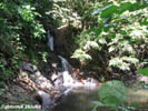
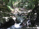
Tamulaya Falls is the centerpiece, literally, of tourist destinations in Polillo. Literally because the tourism poster at the Munisipyo was laid out with the falls at the center. Being a centerpiece may well be justified as it is a popular destination both for locals and visitors. It could be noticed that the photo at the Munisipyo does not feature the dam yet. This dam was built on top of the falls for the general benefit of the public as it is the source of domestic water supply of the town. The water pressure generated by the elevation of the falls can supply even three-storey buildings.
How to get there:
To get to Polillo, go first to Ungos Port in Real, Quezon. A local bus company plies the Lucena-Infanta route originating from Lucena Grand Terminal at one-and-a-half hour intervals with first trip at 4:00AM. Two other bus companies have trips to Infanta originating from Metro Manila. One of them has its terminal in Legarda, Manila. These buses gets through the Famy-Real-Infanta Road. Famy is at the junction with the Rizal-Laguna Road.
There are two regular boat trips from Real to Polillo. The first trip usually leaves at 7:30AM as the bus passengers coming from Lucena and Manila try to catch it up. The next boat leaves at 10:00AM. The boats are outrigger types powered with a surplus truck engine. The return trips from Polillo are at 5:00AM and 1:00PM.
To reach Tamulaya Falls, the best option is to hire a motorized tricycle as it can also get thru the barangay road going to the falls. Otherwise, take the double-tire Polillo-Burdeos jeepney which is waiting at the pier as the boat from Real berths. From Polillo to Barangay Tamulaya is approximately eight (8) kilometers. The landmark to disembark is the Tamulaya-Anibong Elementary School. The barangay road in front of the school is 1.35 kilometers long. The waterfalls is a mere 250meter hike from the end of this road. Hence, if you took the Burdeos jeepney and got off at the corner, your hike would be 1.6 kilometers. But you can also reduce your hike distance if you can find a guide to go thru the woods/coconuts farms. In this option, you must get off the jeepney to start your trek at a point of the road where there could be no landmarks. But the savings of merely half a kilometer may not justify the need to go thru unfamiliar rolling terrain. The other advantage of hiring a tricycle is that you have a sure ride for the trip back to Polillo proper. Otherwise, it is a wait-for-your-luck-to-hitch-a-ride with a copra truck (some are three-wheelers), dump truck or a kuliglig (hand tractor trailer).Waypoint narrative by: GBLontok 2008 follow GBLontok on Facebook
|
|
|