| |
|
|
| |
|
VISITS |
|
756000 |
|
Copyright 2013
waypoints.ph |
|
|
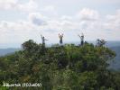
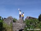
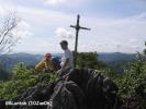
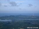
Click on any of the images to see the enlarged copy and narratives of the photo.


The Pinagbanderahan Peak is within the Quezon National Forest Park (see feature in www.pagbilao.org) in the tri-boundary of Atimonan, Pagbilao and Padre Burgos, Quezon. It is one of the highest outcrop along a ridge running east-west among massive limestone formations in the area. It was called Pinagbanderahan because it was used as an outpost during the war. A flag was planted; hence the name. From this vantage point, vessel movements may be observed in Lopez Bay (where the Japanese landed during the invasion) and also in Pagbilao Bay. Strategically, at least four municipalities may be seen from here: Pagbilao, Padre Burgos, Atimonan and Lucena. The view is breathtaking. The zigzag road to the south and the diversion road to the north may also be spotted among the forest cover. And yes, you will be awed to see birds (eagles or hawks) soaring and gliding in the sky. One regret is that the remains of the flagpole is now a mere stub as enterprising scavengers find the metal worth the climb. There are also remnants of excavations done by treasure hunters.
There are actually two peaks in the area. The second one is located about 70m to the west of the first. The first peak has a GPS elevation of 425meters while the second peak is only 421meters. The second peak may be reached with great care while walking along the ridge over limestone formation with deep crevices. Surely, this is not a good place to drop your watch or cellphone.
Footnote:
The Quezon National Forest Park (QNFP) is a 983 hectare forest reservation by virtue of Proclamation No. 594 dated 05 August 1940 and NIPAS ACT R.A. 7586 dated 01 June 1992. It is traversed by the zigzag road which is part of the National Highway between Pagbilao and Atimonan. It is passable to any type of light vehicles. Trucks and buses are discouraged from using this road.
How to get there:
To get to the peak, you need to go first to the Quezon National Forest Park. Excerpts from the feature in www.pagbilao.org is recreated below:
From Pagbilao, just follow the National Highway going to Atimonan. I am going to guide you though on several Y-junctions along the way which may confuse you.The first Y-junction, a few hundred meters after KM 146 and just infront of Binahaan Elementary School, is the access road to Mirant Pagbilao Coal-fired Power Plant (an Independent Power Producer). It is marked by an impressive modern directional sign which looks out of place in a rural setting. Going to the right will take you to the the power plant, so take the left.
The next junction is the one going to Padre Burgos just infront of the Quezon National Agricultural School. It is marked by a politically- initiated welcome arch. Going thru the arch on the right will take you to Padre Burgos, so take the left once more. Now, the school's fence will be along the highway's left side. Use that fence as your guide. Once you reach the end of the fence you will find Amao I Bridge (Amao One). This time, turn right on the Y-junction immediately after this bridge.
So for the three junctions, remember: left, left, then right. From hereon, you are now within the zigzag road of the QNFP. In a mountain road, be wise in choosing the gear you drive with ? and please, obey the signal of the flagmen (or women) at the hairpin turns. Rule of thumb (i.e., rule of gravity): give way to upcoming vehicles.
A little over a kilometer past the Pagbilao-Atimonan boundary (marked with colorful pillar monuments on both sides of the road), find a rest area to your left and park your vehicle there. Store owners in the park would be willing to watch your vehicle. From this parking area, walk back along the road for about 200meters and find the start of the trail to your right. Landmark is the concrete steps and pathwalk with G.I. pipe railing.
Along the trail, you will already enjoy the flora and fauna. The terrain is easy and is mostly concreted or rip-rapped. You will find the mouth of the Cueva Santa (N13?59.7700' E121?48.8480' ) after hiking for about 1120 meters. The terrain remains easy for the next 240 neters. But from hereon (1360 meters from the trail start) the slope becomes steep. After an uphill hike of another 170 meters with a 26meter climb, there is a saddle between two hills. This saddle has concrete/riprap benches and is a nice rest area for you to reenergize for the final attack to the peak. From hereon, the peak is merely 120meters with a 65meter climb. While there are damaged portions in the trail, previous hikers took initiative to provide ropes, cords or wood handrails. The last few steps to the peak is provided with concrete steps carved to the limestone.Waypoint narrative by: GBLontok 2006 follow GBLontok on Facebook
|
|
|