| |
|
|
| |
|
VISITS |
|
756000 |
|
Copyright 2013
waypoints.ph |
|
|
Click on any of the images to see the enlarged copy and narratives of the photo.


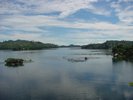
Named as the Summer Capital of South Cotabato,
Lake Sebu is home to the T'boli tribe. Sadly however, with
the denudatation of the surrounding forests much of the beauty that
Lake Sebu was 15 or so years ago when I first visited the place has vanished.
Still there is something to offer for someone adventurous enough
to venture into its remote areas. Situated almost 3000 feet above sea level,
the climate is cool and the air is still fresh. Occassionally, one can
still see T'boli women wearing their traditional attire. The
traditional weaving of the t'nalak (fabric made of abaca fiber)is still around.
But what makes people still go and visit Lake Sebu is the flavor of the
fresh tilapia, caught from the lake to the grill, the taste is almost heavenly.
How to get there
With the concreting of the road leading up to Lake Sebu, it is now very easy
to visit the place. Gone were those days when it took almost four hours
over dirt roads and rivers that overflow during the rainy season, now it's less
than 30 minutes.
From the capital city of Koronadal, one passes thru the towns of
Banga and Surallah. Just a little farther from the poblacion of Surallah
is a junction to the left going to the town of T'boli and a little farther is
another junction to the left going to Lake Sebu.
Waypoint narrative by: madzie_ph 2002 follow madzie_ph on Facebook
|
|
|