| |
|
|
| |
|
VISITS |
|
755987 |
|
Copyright 2013
waypoints.ph |
|
|
Click on any of the images to see the enlarged copy and narratives of the photo.


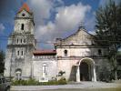
San Gregorio Magno Parish
History of the town:
Ginatilan was once a barrio of the Municipality of Samboan. The place got its name from the word "Hinatdan" due to the frequent bringing of necessary things needed in the celebration of the mass, so the place was called "HINATDAN" and was later changed to "Ginatilan" since the Spanish Officials Found it hard to pronounce the word "HINATDAN".
A large portion of Ginatilan`s land formation is mountainous. Rolling hills and rugged mountain ranges with occasional plateaus and open valleys describe its topography. The highest mountain range has a peak of 816 meters above sea level.
Waypoint narrative by: paulperez 2006 follow paulperez on Facebook
|
|
|