| |
|
|
| |
|
VISITS |
|
755998 |
|
Copyright 2013
waypoints.ph |
|
|
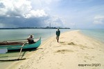
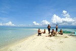
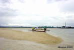
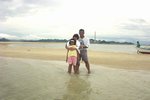
Click on any of the images to see the enlarged copy and narratives of the photo.


Bilaran is a sand bar located about 9km offshore southeast of Pagbilao, Quezon in Pagbilao Bay. In english, its name means: "A place where things are dried by exposing them to the sun".
Beautiful as it already seems in these pictures, fishermen say that this sand bar was so much longer, wider and lovelier not so long ago.
Sadly, people have exploited the white sand and have quarried the sand by the truckloads through the years to sell as decorative and building materials. A lot has probably been quarried indeed. When you go near the sand bar, you can see the great expanse of white sand and white rock bed under water for over 2km from the sand bar. You can actually see this expanse on the satellite image view available via the vicinity information link above (switch to satellite view on the vicinity map on that page)
It was most certainly a coral reef then too. Now all you can see are just rocks and sand underwater.
Bilaran is also known as Panambo and Balugbog-Baboy (Pig's Nape). For whatever is left of it, Bilaran is still a nice place to go to. It has calm, clear waters all around it. It is also a nice side trip destination when going to other places in Pagbilao bay. It offers several unobstructed views all around like Mount Banahaw on the northwest, Pagbilao Grande on the east and Marinduque on the southeast.
How to get there
Bilaran is best accessed from Bantigue, a fishing village area south of Pagbilao. It is the nearest point to Bilaran that we know of where you can hire a motor banca to take you to the sand bar. Bilaran is about 3.3km southeast of Bantigue.
To get to Bantigue, you need to be on the National Road between Lucena and Pagbilao. A short distance from kilometer post KM135, look out for a small short bridge (go slow as
it is easy to miss this bridge). A current landmark near the bridge is the GreenView Hotel.
Turn right (southward) on the road right after the bridge (between the bridge and the hotel). After about 7km on this amazingly very good concrete road, you will end up at what should look like a golf driving range facility (with matching nets up in the air) and what would seem like a dead end. Head straight on into the single lane road that skirts the facility. About 500m into this narrow road, you will end up near the beach of Bantigue where you will see a lot of
fishing bancas on the shore. You can inquire from the people in the area about hiring a banca to take you to Bilaran or to Kwebang Lampas.
Tips
Timing is important. You should schedule your trip during low tide, early in the morning and fine weather. The sand bar appears on low tides and is completely submerged during high tides. Early morning trips are recommended as, with most sand bars, there is nothing on the island ... no shade! And the seas are calmer on early mornings. Boatmen in the area refuse to go to the sand bar when the seas are rough.
Pagbilao and its surrounding tourist spot potentials like this Bilaran Sand Bar is currently being documented by Gerry Lontok who hails from Pagbilao. You can learn more about Bilaran by visiting his Wow Pagbilao
blog site.
Waypoint narrative by: EPPGarcia 2002 follow EPPGarcia on Facebook
|
|
|