| |
|
|
| |
|
VISITS |
|
755959 |
|
Copyright 2013
waypoints.ph |
|
|
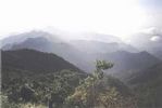
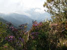
Click on any of the images to see the enlarged copy and narratives of the photo.


Starts at Makalama, a sitio of Barlig, Ifugao up to Mount Amuyao at 2,628 Meters ASL down to the Bangaan and Batad junction in 20 walking hours in 3 days.
Mt. Amuyao is the 8th highest mountain in the Philippines with an elevation of 2,628 meters (8.865 feet). The summit shows a breathtaking panorama of the entire Cordillera range.
To get to Makalama in Barlig go to Banaue via North Expressway. Connect to the road going to Bontoc. About two hours by jeep or an hour and a half via private vehicle.
Jump off at Makalama. Trek about 4 hours to the Peak. Descend via other side leading to Pat-yay, Cembulo and Batad for two days. Return at the Batad/ Bangaan/ Banaue junction which is about 30 minutes away from the center in Banaue.
Waypoint narrative by: Chito Razon 2002
|
|
|