| |
|
|
| |
|
VISITS |
|
755956 |
|
Copyright 2013
waypoints.ph |
|
|
Click on any of the images to see the enlarged copy and narratives of the photo.


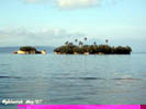
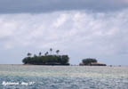
Pagol Island is a group of rock outcrops jutting out of the water approximately 900 meters offshore of the Poblacion of Rapu-rapu, Albay. During low tide, one can actually wade thru the water from the shore to the island. The island has caves, a natural bridge and some flat areas along the shores making it a favorite picnic destination. Indeed, the vandalisms carved out into the rocks and hard clay proves it. Some visitors refer to it as Turtle Island due to the shape of one of the outcrops which features the likeness of an animal with a stretched neck and its head dipped into the water. The neck forms the natural bridge.
While this land form does not appear in most maps, it is said that somebody owns the island. There is even a farm on top of the biggest outcrop.
During this visit, insufficient time and daylight prevented us from setting foot on the island. So, GPS data was recorded by circling the islands with a rented boat.
How to get there?
The island municipality of Rapu-Rapu, Albay which also includes the nearby Batan Island can be reached by a three-hour boat ride from Legazpi Port. As of this writing, there are two scheduled boat trips daily. One departing at 7:00AM and another at noon time. There are corresponding return trips from Rapu-rapu leaving at similar hours. The morning trip to Rapu-rapu stops-over to drop off and embark passengers at two or three locations in nearby Batan Island. Without going ashore, the boat transfers or receives passengers from smaller boats, which ferries the passengers to or from Batan. The noon time boat skips Batan and goes direct to Rapu-rapu. Rapu-rapu Port is a rock embankment type with a length of approximately 300 meters. Waypoint narrative by: GBLontok 2007 follow GBLontok on Facebook
|
|
|