| |
|
|
| |
|
VISITS |
|
756000 |
|
Copyright 2013
waypoints.ph |
|
|
Click on any of the images to see the enlarged copy and narratives of the photo.


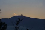
With a recorded peak altitude of 2025 meters, Mt Cabuyao
is the second highest peak near Baguio City. It is just about 2.6km from Mt. Sto. Tomas which is the highest peak near Baguio. Mt. Cabuyao is usually mistaken for as Mt. Sto. Tomas. From the east side of the
peak, you can see the whole city of Baguio including its suburbs and
the Baguio airport. From the west side, you can view the China Sea
How to get there
The peak can be reached by road from Marcos highway. From Baguio City,
go through Marcos highway and, near the city boundary, opposite a Petron gasoline
station, you will see the junction the leads to Mt. Sto. Tomas. Simply
follow the road which is 8.5km from the Marcos highway junction to the
transmitter site. There will be two Y junctions along the way. Just
take the road to the right on each of the junctions.
Tips
While the peak is accessible by vehicles. Be prepared though to go through
steep dirt roads. About half of the 8.5 km stretch is good concrete surface,
while the rest is dirt road. During summer or when there are no rains, it is possible
to bring a car to the peak. However, when the road gets wet, the road is better
traversed with a jeep or a 4-wheel drive vehicle.
To get a good view of the city, go to the peak in the morning. Almost immediately
after noontime (everyday!), thick fog from the northwest side of the mountain creeps in and all you
would be able to see is the fog which can reduce visibility down to less than 10 meters.
This is a popular mountain bike trail. It is also popular among hikers and
dirt motorcycle riders. You may want to consider trekking the road
on a mountain bike or motorcycle or hiking it.
Waypoint narrative by: EPPGarcia 2002 follow EPPGarcia on Facebook
|
|
|